Sentinel-2 imagery, enhanced to 1 metre.
Ten spectral bands, any land area Sentinel-2 covers, any date since 2017. Draw your area, pay per km², download the GeoTIFF.
What you receive
All ten spectral bands, delivered on a single 1 m grid.
- 10 bands (B02–B12) on a 1 m grid, model-enhanced from the 10 m and 20 m source
- True colour, false colour and NDVI products included
- GeoTIFF ready for QGIS, ArcGIS and Python
Coverage
84°N – 56°S
Archive
2017 – present
Delivery
Next working day
Output
10-band GeoTIFF, 1 m grid
Samples
Real scenes, real output. Drag to compare.
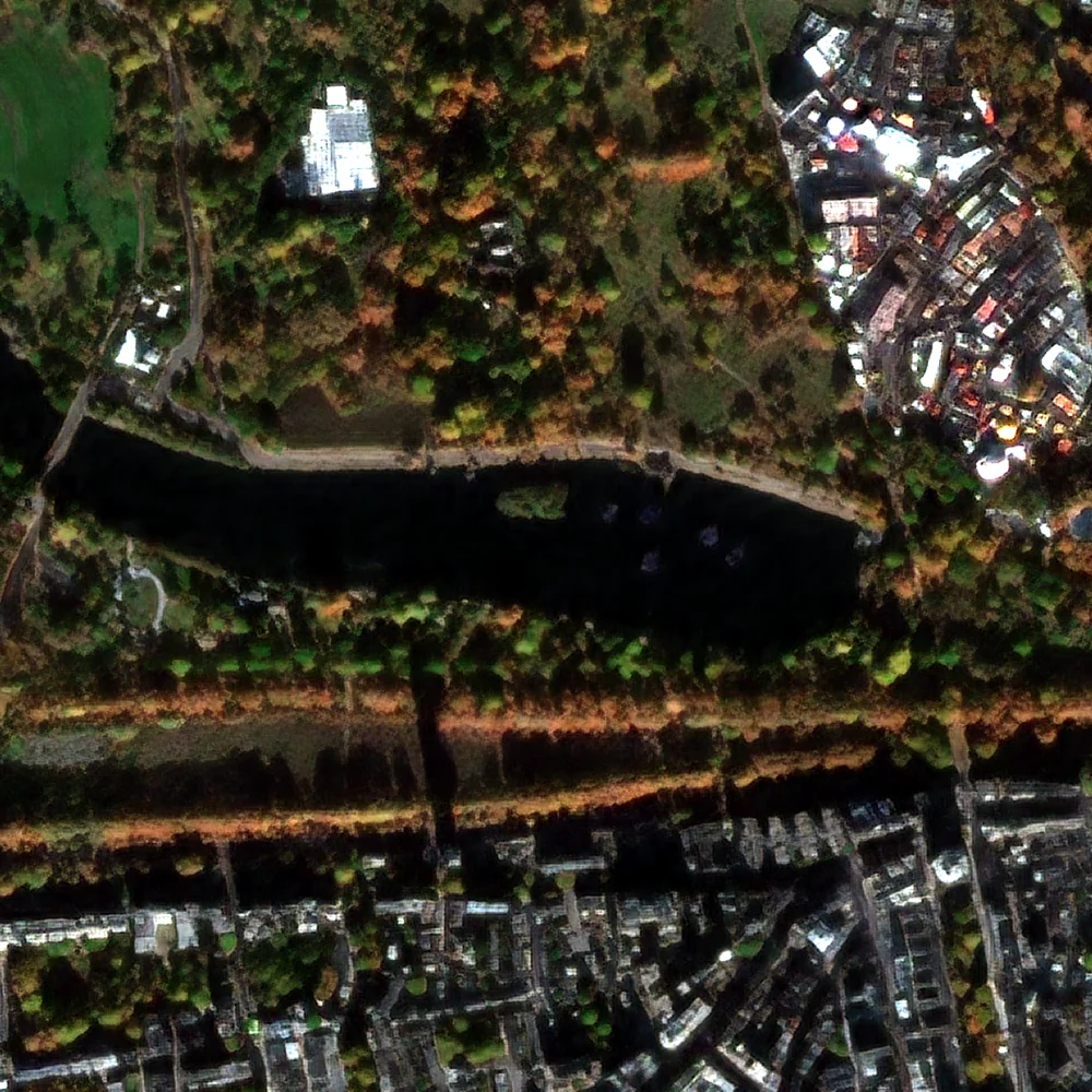
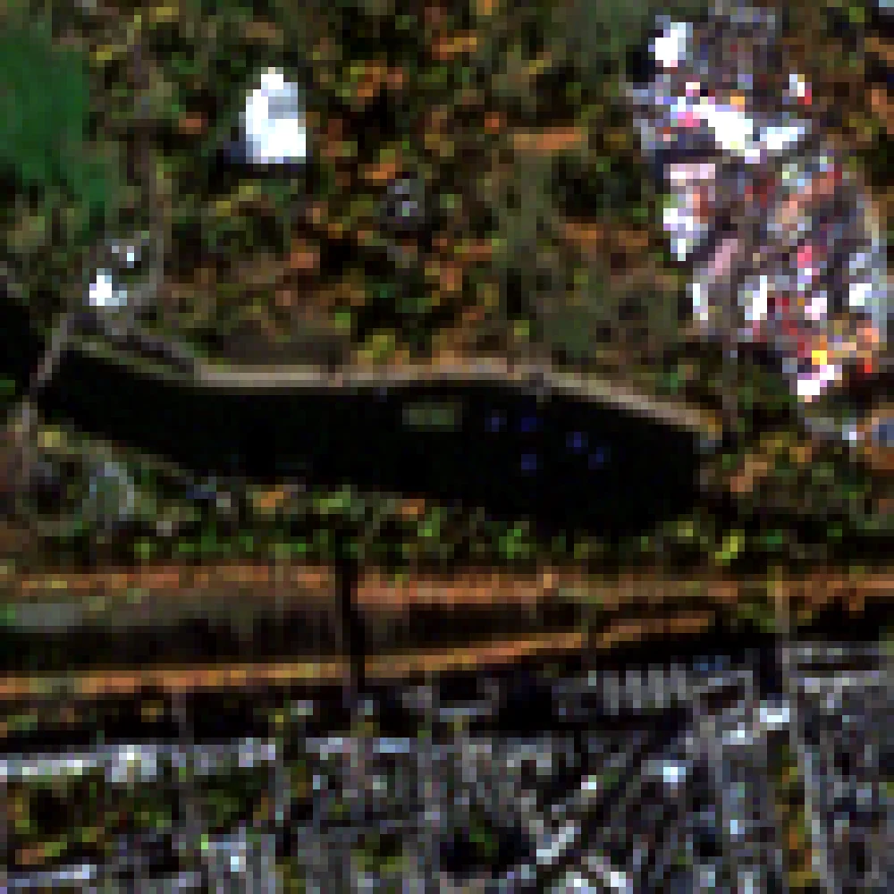
Each image is an unedited crop from a Novascope run. Left: the original 10 m Sentinel-2 pixels. Right: our 1 m model output from the same scene and bands.
Cities
Hyde Park and Kensington
Dense city fabric: streets, rooftops and park paths resolve at 1 m.
Band combination
Natural colour, as the eye would see it.
- Acquired
- 16 Nov 2026
- Scene
- S2B_30UXC_20261116_0_L2A
- Location
- London, United Kingdom
- Detail window
- ≈ 1.2 km
Output is model-enhanced from Sentinel-2; validate before use in measurements. Contains modified Copernicus Sentinel data 2026.
Delivered bands
How it works
Order in minutes. Files by the next working day.
- 01
Draw your area
Sketch a polygon on the map or upload GeoJSON. The price per km² shows before you pay.
- 02
Pay securely
Card payment through Stripe in your currency. Nothing is processed until payment clears.
- 03
We process
Our team selects the clearest scene in your date window, runs the model and checks the output before delivery.
- 04
Download
A 1 m, 10-band GeoTIFF with true-colour and NDVI products in your dashboard by the next working day, kept for 30 days.
Who uses it
Detail at the scale of a field, a street or a site.
Agriculture
Field boundaries, crop rows, irrigation and NDVI at the scale of a single field.
Urban planning
Building footprints, road networks and green space from any Sentinel-2 date since 2017.
Insurance & finance
Check land use and assets across many sites from archive imagery.
Forestry & environment
Canopy gaps, clearings and water bodies, compared across dates.
Infrastructure
Roads, pipelines, construction sites and ports along their whole length.
Research & GIS
10-band GeoTIFFs in UTM that open directly in QGIS, ArcGIS and Python.
Models
Two models: clear-sky or all-weather.
Both take the ten Sentinel-2 L2A bands at 10 and 20 m and return the same ten bands on a 1 m grid. They differ in what they do with clouds.
ZAR-3
Clear-sky super-resolution
Sentinel-2 L2A, 10 bands at 10/20 m, enhanced to a 1 m grid. For cloud-free scenes; the lower-priced tier.
- Input → output
- 10 bands at 10/20 m → 10 bands, 1 m grid
- Cloud and haze
- Requires a clear scene
- Reflectance
- Source scale (uint16 × 10,000)
- Products
- 10-band GeoTIFF, true colour, NDVI
€2.00 / km²
Self-serve, order today
HAH-5
All-weather super-resolution
Everything ZAR-3 does, plus cloud and haze handling for areas where clear scenes are rare.
- Input → output
- 10 bands at 10/20 m → 10 bands, 1 m grid
- Cloud and haze
- Handled by the model
- Reflectance
- Source scale (uint16 × 10,000)
- Products
- 10-band GeoTIFF, true colour, NDVI
€3.00 / km²
Early access for enterprise clients
Pricing
Pay per square kilometre. No subscription.
Prices are set in euros and shown in your currency at checkout. Self-serve orders: 5–500 km², at most 30 km on the longest side. You are billed for the bounding box of the area you draw.
Self-serve
€2.00 / km²
ZAR-3 model, 1 m, 10 bands. Minimum 5 km²; 10% off from 50 km², 20% off from 200 km². Drawing an area works best on a larger screen.
Start an orderEnterprise
Custom
Above 500 km², repeat orders on a schedule, or custom products.
- Private contract and invoice billing
- Large areas split into scheduled batches
- Bulk delivery to your own storage bucket
- Custom indices and band stacks
- NDA and data processing agreement on request
Is this real 1 m imagery?
No. Novascope starts from Sentinel-2's 10 m and 20 m bands and uses a deep super-resolution model to produce a 1 m grid. Edges, roads, field boundaries and buildings become much sharper and values stay on the source reflectance scale, but it is a model estimate, not a 1 m sensor. Our validation against 3 m reference imagery shows real detail down to roughly 5 m; finer texture is generated. For surveying-grade measurements use a native very-high-resolution sensor.
Which areas and dates can I order?
Any land Sentinel-2 covers (84°N to 56°S) and any date since 2017, up to 500 km² and 30 km across per order. You give a date window and a cloud limit; we pick the clearest scene inside it.
What do I receive?
A tiled, compressed GeoTIFF with 10 bands (B02, B03, B04, B05, B06, B07, B08, B8A, B11, B12) at 1 m in UTM, uint16 reflectance × 10,000, plus an 8-bit true-colour GeoTIFF and an NDVI GeoTIFF. Files are typically 50 MB to several GB; you download them from time-limited links in your dashboard.
How long does it take?
Orders are processed by our team and delivered by the end of the next working day after payment clears. We do not send e-mail notifications; the download links appear on the order page in your dashboard.
What if my area is cloudy on the date I want?
ZAR-3 needs a clear scene; we search your date window and tell you which scene was used. If no scene meets your cloud limit we contact you to adjust the window or refund the order in full. For areas that are rarely clear, the HAH-5 all-weather model is available to enterprise clients.
Can I pay in my own currency?
Yes. Prices are set in euros and converted at checkout to the currency you choose in your account. Enterprise clients can be invoiced.
Can I use the output commercially?
Yes. You receive a non-exclusive, perpetual licence to use the delivered files for internal and commercial purposes, including in reports and analyses for your clients. Redistributing the rasters as a dataset is not permitted. When you publish the imagery, credit it as "Contains modified Copernicus Sentinel data [year], processed by Novascope".
Draw your area and see the price before you pay.
Create an account, outline the area on a map and get a quote in seconds.